Paper, Instinct, and a Healthy Fear of Wrong Turns: Navigating America Before GPS Existed
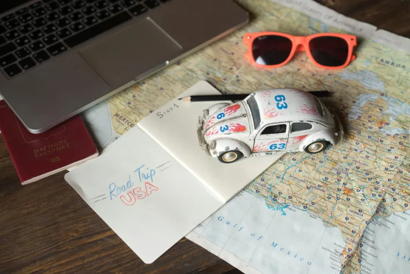
Paper, Instinct, and a Healthy Fear of Wrong Turns: Navigating America Before GPS Existed
Somewhere in a glove compartment in 1987, there is a map of the American Southwest that has been folded incorrectly so many times it's basically a crumpled artifact. The crease lines don't match the original folds anymore. Someone has circled a town in pen, drawn a dotted route in pencil, and written "DO NOT TAKE 66 AFTER FLAGSTAFF" in the margin in capital letters. Nobody remembers why.
That map — and the million others like it stuffed into dashboards across the country — was once the primary navigation technology available to the American road tripper. No voice prompts. No real-time rerouting. No little blue dot pulsing along a glowing screen. Just paper, patience, and the vague hope that you were reading the scale correctly.
The Map Was the Plan
Before you left for a long drive in the pre-GPS era, you planned. Not in the casual, loose way that modern travelers might glance at a route on their phone the night before. You planned. You spread the map across the kitchen table, traced the route with your finger, noted the highway numbers, identified the towns where you'd stop for gas, and — if you were particularly organized — wrote the key turns on a notepad that lived on the passenger seat for the duration of the trip.
AAA members could request a "TripTik" — a custom, spiral-bound booklet of route maps assembled by the club specifically for your journey. It was a remarkable service, and people treated those booklets like sacred documents. Losing a TripTik mid-trip was a minor emergency.
Gas stations, meanwhile, gave away free maps for decades — a practice that quietly disappeared sometime in the 1990s as the industry consolidated and the maps became less necessary. At their peak, oil companies like Esso and Gulf printed hundreds of millions of maps annually. They were marketing tools, yes, but they were also genuinely useful infrastructure for a country built around the automobile.
The Human GPS: Asking for Directions
When the map failed — and it failed — you asked someone. This was not optional. It was the only alternative. You pulled into a gas station, a diner, or a roadside store and approached a stranger with your best approximation of where you were trying to go.
This exchange had its own culture. Gas station attendants (and yes, attendants were still a thing in much of the country through the 1980s) were expected to know the local roads. Diner regulars would weigh in from their stools. Directions were given in a distinctly American vernacular: "Go down past the old Miller farm — the barn's still red — and turn left at the water tower. You can't miss it." You could absolutely miss it.
Directions were sometimes wrong. They were sometimes confidently, enthusiastically wrong. And there was no way to know until you'd driven twenty minutes in the wrong direction and the landscape stopped matching anything you'd been told to expect.
The Very Real Possibility of Ending Up Somewhere Else
Getting lost on an American road trip before GPS wasn't a quirky inconvenience. It was a genuine possibility that every traveler accepted as part of the deal. People crossed state lines by accident. People drove an hour in the wrong direction before realizing the sun was on the wrong side of the car. People arrived at their destination two hours late and deeply relieved.
On interstate highways, the system of numbered exits and consistent signage made things manageable. But venture off the main arteries — into rural routes, two-lane state roads, or the tangled suburban sprawl around any major city — and the margin for error expanded dramatically. City driving in an unfamiliar place was its own particular ordeal. One wrong merge on a freeway interchange and you could spend thirty minutes trying to work your way back to where you started.
The passenger seat had a job. The person riding shotgun was the navigator, and it was a real responsibility. Couples argued over maps. Families pulled over in silence while a parent stared at a road atlas trying to figure out which county line they'd just crossed. The navigator who missed a turn bore a specific kind of guilt that GPS has completely eliminated from American family road trip culture.
What the Open Road Felt Like Then
Here's the thing nobody quite says out loud when they talk about navigating by paper: it made the trip feel bigger. The unknown was real. You didn't know exactly when you'd arrive. You didn't know precisely what was between here and there. You might discover a town you'd never heard of because you turned down the wrong road and found something worth stopping for.
There was an intimacy with the landscape that came from actually having to read it. You noticed landmarks because they were your reference points. You knew which direction the mountains were. You paid attention in a way that a glowing screen quietly removes from the experience.
None of that is to say the old way was better. Getting genuinely lost at night in an unfamiliar city, with no way to quickly reorient, is not romantic. It's stressful. The freedom that GPS handed to American drivers — especially solo travelers, especially women traveling alone — is significant and real.
The Chasm Between Then and Now
Today, your phone knows where you are before you've decided where you're going. It anticipates traffic, suggests detours, and tells you the exact minute you'll arrive. The uncertainty that used to be woven into every road trip has been almost entirely engineered away.
What remains is a quieter, faster, more reliable version of the open road. What's gone is the particular texture of not knowing — the slightly elevated heartbeat of realizing you might be lost, the satisfaction of finding your way back, and the worn, coffee-stained map that proved you'd been somewhere and figured it out.